SURVEYING, DESIGN, AND PROTOTYPING SERVICES
DRONE SURVEYS
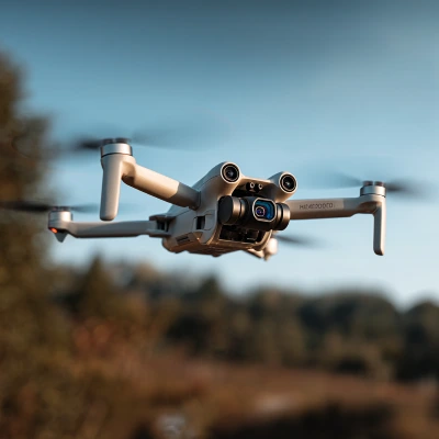
ATS are an innovative team and have been involved with drones for over 30 years. Our original experience was designing, building and operating military target drones.
Our Certified Drone Fleet is used for a variety of specialist services.
These services include:
- Professional Aerial Photography & Videography
- Cinematography Services
- Telecommunications Site Surveys
- Promotional and Marketing Aerial Work
TELECOMMUNICATION AND PANORAMIC SURVEYS

We have been providing Photographic and Panoramic Surveys to the telecoms industry since 2002.
Since that time our name and reports have become the recognised standard in the industry.
We have provided this service for every mobile operator in the UK.
Key Facts & Capabilities:
- Provided over 33,000 site reports on our data bases.
- We operate a fleet of drones, including DJI Mavic 2 Pro and 4 GVC-qualified drone pilots.
- The DJI Mini 3 Pro allows us to access structures and sites that larger drones or human access cannot safely reach.
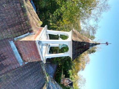
CHIMNEY SURVEYS

Our photographic roof and chimney survey services are now the preferred method for many property management companies to keep on-going records of their property portfolios.
By using our drones, our operators work safely from ground level thus minimising health and safety issues as well as added costs from things like scaffolding or cherry pickers.
Client Benefits & Cost Savings:
- Our certified operators work safely from ground level, eliminating the high safety risks and liability of scaffolding or cherry pickers.
- Minimizes additional costs associated with hiring access equipment.
- Surveys efficiently identify specific repair requirements (roofs, windows, gutters, etc.).
- Provides high-quality imagery to document and update the stock condition for external building items.
EXAMPLES


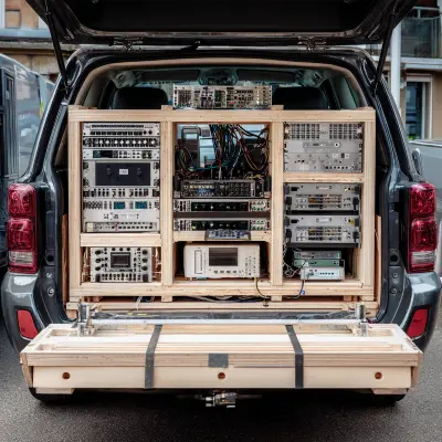
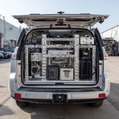
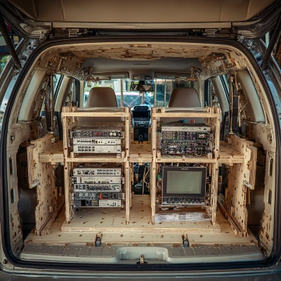
BESPOKE BUILDS AND PROTOTYPING
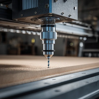
We understand that off-the-shelf solutions often fall short of meeting unique technical and environmental challenges.
That's why we offer a comprehensive service to design, build, and integrate specialized hardware, including vehicle-mounted telecommunications gear, sensor arrays, and custom mounting solutions.
Key Benefits:
- Fast Turnaround: Speed up your product development lifecycle.
- Design-for-Manufacture: Prototypes built with an eye toward efficient mass production.
- Iterative Process: Expert advice and technical support at every stage of refinement.
EXAMPLES